Jago Times "English Edition" Best Online Newspaper
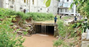
ISLAMABAD: A private housing society in alleged connivance with Capital Development Authority (CDA) and Islamabad administration not only reduced the size of the natural stream in E-11/2 but also altered natural flow of the water way, which caused urban flooding after the heavy rain on Wednesday. Old satellite images taken in 2002 and in 2008 showed the zigzag nullah entering …
Read More »Satellite images confirm ‘tampering’ with E-11 nullah’s route in Islamabad
July 30, 2021